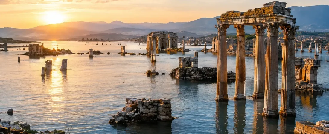
A river in flood is not a gentle historical backdrop. It is brown water pressing against mudbrick walls, reeds caught in doorways, grain stores threatened, and families climbing toward the highest ground they can find. So, why did ancient cities flood so often in history? The short answer is that many of the world’s first great cities were built precisely where water was most useful – and most dangerous.
Rivers carried drinking water, fish, fertile silt, transport routes, and the means to irrigate crops. Coasts opened access to trade. Marshes supplied reeds and wildlife. Yet the same landscapes could turn against a settlement in a day, a season, or a generation. Ancient people were not careless about this risk. They built canals, levees, drains, embankments, and raised platforms. But nature changed course, storms exceeded expectations, and human engineering sometimes made the danger worse.
Why Did Ancient Cities Flood? Water Made Cities Possible
The earliest urban centers did not emerge by accident. In southern Mesopotamia, between the Tigris and Euphrates, communities depended on river water to farm a dry plain. Cities such as Ur, Uruk, and Nippur grew within a managed landscape of canals and fields. Without irrigation, there would have been no agricultural surplus to support priests, potters, merchants, scribes, laborers, and rulers.
But the Tigris and Euphrates were unpredictable rivers. Their floods did not always arrive at the most useful time for crops, and their channels could shift across the flat alluvial plain. A breached canal or failed embankment could send water across cultivated land and into neighborhoods made largely of sun-dried mudbrick. Mudbrick was practical and widely available, but prolonged saturation could weaken walls, collapse roofs, and erase streets beneath layers of silt.
This was the ancient bargain: settle near water and gain prosperity, or settle farther away and struggle to sustain a large population. Most cities chose the risk.
Flood layers and the limits of archaeology
Archaeologists have found thick deposits of river-borne silt beneath some Mesopotamian settlements, including layers at Ur and Kish. Early excavators sometimes treated these discoveries as evidence for a single, civilization-wide flood that might explain later flood traditions. The evidence is more complicated.
Flood deposits at different sites often belong to different dates. They point to repeated local or regional disasters, not necessarily one event that covered all Mesopotamia at once. That distinction matters. Ancient flood stories may preserve memories of real catastrophes, but archaeology rarely supports a simple one-to-one match between a legend and a particular layer of mud.
Rivers Moved, and Cities Could Not Always Move With Them
A river is never truly fixed. Over centuries, sediment builds up in channels, banks fail, and floods cut new paths through low ground. This process, called avulsion, could transform an urban landscape with startling speed.
For a city, a changing river brought two opposite threats. Too much water meant flooding. Too little water could mean that the river had migrated away, leaving canals dry, harbors stranded, and farmland harder to irrigate. Ancient cities were often vulnerable not simply because they stood beside rivers, but because they were built around a particular river course that could not be counted on forever.
Mohenjo-daro, one of the great cities of the Indus Valley Civilization in present-day Pakistan, offers a vivid example of this uncertainty. Archaeologists have identified flood deposits and rebuilding episodes at the site. Its inhabitants repeatedly raised floors and constructed on top of earlier structures, adapting to water and sediment over time. Yet scholars do not agree that flooding alone caused the city’s eventual decline. Changes in river systems, shifting trade networks, environmental pressures, and broader social changes may all have played a part.
That is a recurring lesson from ancient disasters: a flood may be devastating without being the sole explanation for a civilization’s transformation.
When Urban Success Increased the Risk
Cities changed the water around them. As populations grew, residents paved surfaces, narrowed natural drainage routes, dug canals, and built walls intended to hold water back. These projects could protect a district in an ordinary year, but they also created dependencies. A canal needed clearing. A levee needed repairs. A blocked drain could turn heavy rain into a neighborhood emergency.
Roman cities show how advanced engineering could reduce flood damage without eliminating it. Rome itself depended on the Tiber River for transport and commerce, but the river regularly rose above its banks. Low-lying areas near the Forum and the Campus Martius were especially exposed. The Cloaca Maxima, one of Rome’s famous drainage systems, helped carry water and waste away from parts of the city. It was an extraordinary work of engineering, but it could not command the Tiber during a major flood.
Floods were woven into Roman civic life. They damaged buildings, interrupted trade, spread contamination, and could be interpreted as ominous signs. Imperial authorities repaired riverbanks and public infrastructure, partly because managing water was a practical necessity and partly because it demonstrated that rulers could restore order after chaos.
The danger hidden in drainage
Drainage was a trade-off. Channels and sewers carried unwanted water away, but if a river rose high enough, it could force water backward through the system. In a densely settled city, refuse, animal waste, and standing water created health risks long before anyone understood germs.
This is one reason ancient flooding was rarely only a moment of destruction. The water’s retreat began another crisis: cleaning homes, salvaging food, repairing wells, preventing disease, and rebuilding streets before the next season arrived.
Coasts, Storms, and the Sea’s Sudden Reach
Not every ancient flood came from a river. Coastal cities faced storm surges, high tides, and, in rare but terrifying cases, tsunamis. Mediterranean ports were magnets for wealth because they connected merchants and empires. They were also exposed to the sea.
The ancient harbor city of Alexandria, founded on Egypt’s Mediterranean coast, lived with the possibilities of coastal inundation and seismic disturbance. Parts of its ancient waterfront are now underwater, though this was likely the result of several processes over many centuries, including earthquakes, subsidence, and rising sea levels rather than one simple catastrophe. Underwater archaeological remains around the old harbor remind us that a coastline can change as decisively as a riverbank.
In the Aegean world, the massive Bronze Age eruption of Thera, now Santorini, likely generated tsunamis that affected nearby coasts. The precise effects on individual settlements remain debated, but the event reveals a larger truth: ancient communities could understand seasonal floods, yet they had little defense against a sudden wave driven by an earthquake or volcanic collapse.
Climate Could Turn a Familiar River Into a Threat
Ancient flood risk also depended on climate. A river system adapted to ordinary seasonal rains could be overwhelmed by an unusually wet period, rapid snowmelt, or a sequence of powerful storms. Conversely, drought could encourage people to settle more intensively along the remaining watercourses, placing more homes and fields in vulnerable zones.
The Nile is often described as a gift to ancient Egypt, and it was. Its annual inundation renewed fields with fertile sediment and helped sustain one of the longest-lived civilizations in history. But the Nile’s flood was not equally beneficial every year. A flood that was too low could bring poor harvests; one that was unusually high could damage settlements, dikes, and crops. Egyptian administration paid close attention to water levels because the height of the inundation had direct consequences for food supplies and taxes.
This pattern complicates the idea that ancient people merely endured nature. They observed it carefully. They measured rivers, maintained canals, organized labor, and stored grain. Their knowledge was sophisticated, but it worked within limits set by weather, terrain, and the available technology.
What Ancient Floods Reveal About Human Resilience
After a flood, many cities did not vanish. They rebuilt higher. At Mohenjo-daro, repeated construction raised parts of the settlement above earlier flood deposits. In Mesopotamia, workers restored canals and embankments because agriculture demanded it. In Rome, repairs to bridges, drains, and riverfront structures renewed the city after damage.
These responses were not equally available to everyone. Elites might retreat to safer ground or command labor for repairs, while poorer households often lived in more exposed areas and had fewer resources to recover. Floods could therefore sharpen existing inequalities, turning a natural hazard into a social disaster.
For historians, flooded streets and silt-filled rooms are more than evidence of ruin. They reveal choices. A city’s drains show what its builders expected. Its rebuilt walls show what residents refused to abandon. Its flood deposits show that survival was often a cycle of loss, labor, memory, and return.
The next time you encounter the ruins of an ancient city beside a river, harbor, or marsh, look beyond the beauty of the location. Water was the city’s lifeline, its highway, its pantry, and sometimes the force that entered through the gates. Reading that landscape closely is one of the best ways to meet the people who once lived there – not as distant victims of disaster, but as skilled communities continually negotiating with the water that made their world possible.